
New discoveries #7
Cloud effects, Vehicle detection in NZ, Spacenet 8 winners & SolarDK dataset

Welcome to the 7th edition of the newsletter. I am delighted to share that the newsletter now has 1788 subscribers 🥳
Explaining the Effects of Clouds
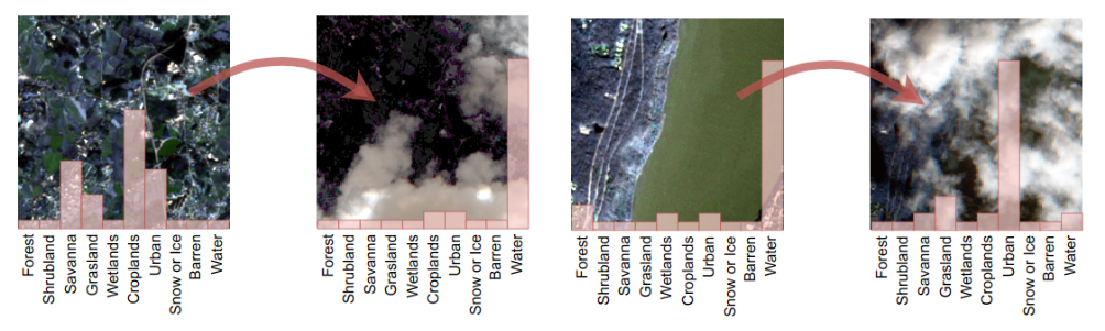
This first discovery is the paper ‘Explaining the Effects of Clouds on Remote Sensing Scene Classification’ published in the IEEE Journal of Selected Topics in Applied Earth Observations and Remote Sensing. This paper explores the effects of haze and cloud coverage on a scene classification task, and the image above shows how the predictions of a classifier can be altered due to the presence of cloud. Clouds considerably alter the spectral characteristics of data and make individual land cover types less separable from one another. The paper highlights how classifiers trained on cloud-free image data often fail once they encounter real world imagery containing clouds. Based on a multistage analysis, including explainability approaches applied to the predictions, the paper illustrates four different types of effects that clouds have on scene prediction. Given that clouds cover over 50% of the planet's surface at any point, it is important that their effects be understood on ML applications.
Authors: Jakob Gawlikowski; Patrick Ebel; Michael Schmitt; Xiao Xiang Zhu
📖 paper
💻 Github
🎥 Related video: Satellite Cloud Generator with Mikolaj Czerkawski
Vehicle detection in NZ
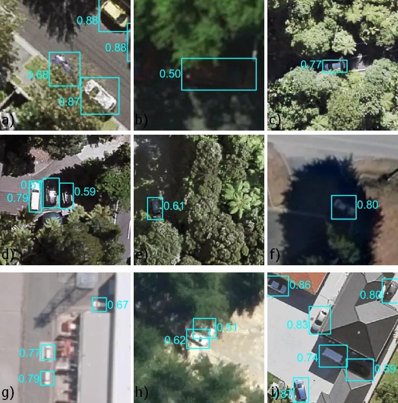
This discovery is a blog post by Grant Pearse on detecting vehicles across New Zealand without collecting local training data. Grant lists many datasets he combined to create a training dataset, and discusses some of the issues he encountered on pooling the datasets. The final results are impressive, and accompanied by an analysis of the failure cases. Overall I enjoyed reading this post as it reflects the kind of work I believe is commonly undertaken outside of academia, and offers many practical insights.
Spacenet 8 winners
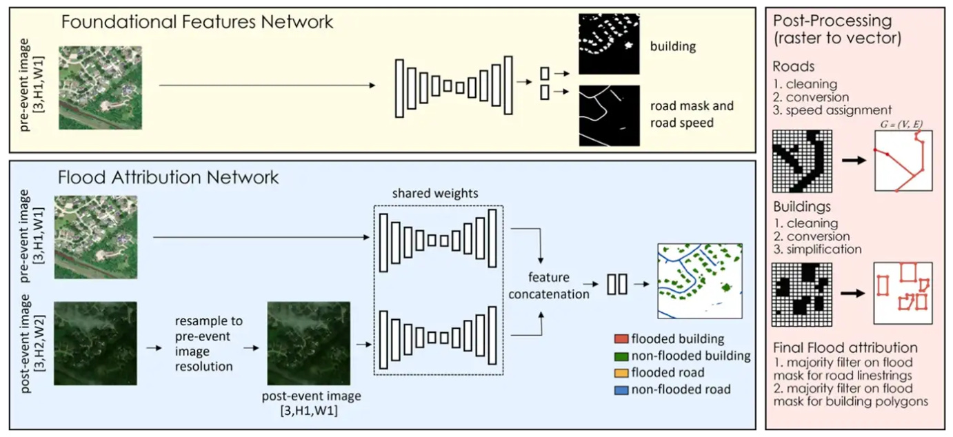
The winners of the 8th Spacenet competition have now been announced, with a summary of the approaches taken by the winners in the blog post below. The challenge for the competition was to perform flood, building and road detection using segmentation. A baseline solution was provided (shown above), consisting of U-Net style segmentation model with a ResNet34 encoder. Post processing steps were provided to refine pixel masks into vectors. Entrants were allowed to use datasets from previous Spacenet competitions, and make use of alternative datasets. Most winning entrants built upon the baseline U-Net solution, including optimising the data augmentation strategy, cleaning bad training data, ensembling multiple models, experimenting with encoders & loss functions, and refining the post processing procedure. All winning entrants achieved a significant improvement in model performance over the baseline solution, and the winning solution from Ohhan77 also achieved a significantly quicker inference time than other winners. Encouragingly, whilst the first and third place solutions came from teams, the other three winners were individual contributors.
SolarDK dataset
SolarDK is a high-resolution urban solar panel image classification and localization dataset. Annotations are provided for classification and segmentation. Benchmarking is performed on several models with ConvNext scoring highest for classification and ResNet50-DeepLabV3Plus highest for segmentation. Given that many solar datasets in the past have focussed on very large solar farms, it is great to see a dataset focussed on solar panels in an urban environment.
Video: Worldsphere.ai with Eduardo
In case you missed it, I posted a new video where I caught up with Eduardo to discuss Worldsphere.ai, which is a platform Eduardo has developed for hurricane wind speed prediction using deep learning models 👇
Poll
Last week I asked ‘Do you have ML models in production?’, with responses roughly equally split between `Yes!` and `No, but plan to in the future`. It is very encouraging to hear that ML models are making their way into real world applications. This week I am interested to know which kind of models people have in production (or plan to deploy):