


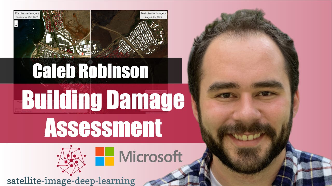
In this episode, I caught up with Caleb Robinson to learn about the building damage assessment toolkit from the Microsoft AI for Good lab. This toolkit enables first responders to carry out an end-to-end workflow for assessing damage to buildings after natural disasters using post-disaster satellite imagery. It includes tools for annotating imagery, fine-tuning deep learning models, and visualizing model predictions on a map. Caleb shared an example where an organisation was able to train a useful model with just 100 annotations and complete the entire workflow in half a day. I believe this represents a significant new capability, enabling more rapid response in times of crisis.
Bio: Caleb is a Research Scientist in the Microsoft AI for Good Research Lab. His work focuses on tackling large scale problems at the intersection of remote sensing and machine learning/computer vision. Some of the projects he works on include: estimating land cover, poultry barns, solar panels, and cows from high-resolution satellite imagery. Caleb is interested in research topics that facilitate using remotely sensed imagery more effectively.


